
Description
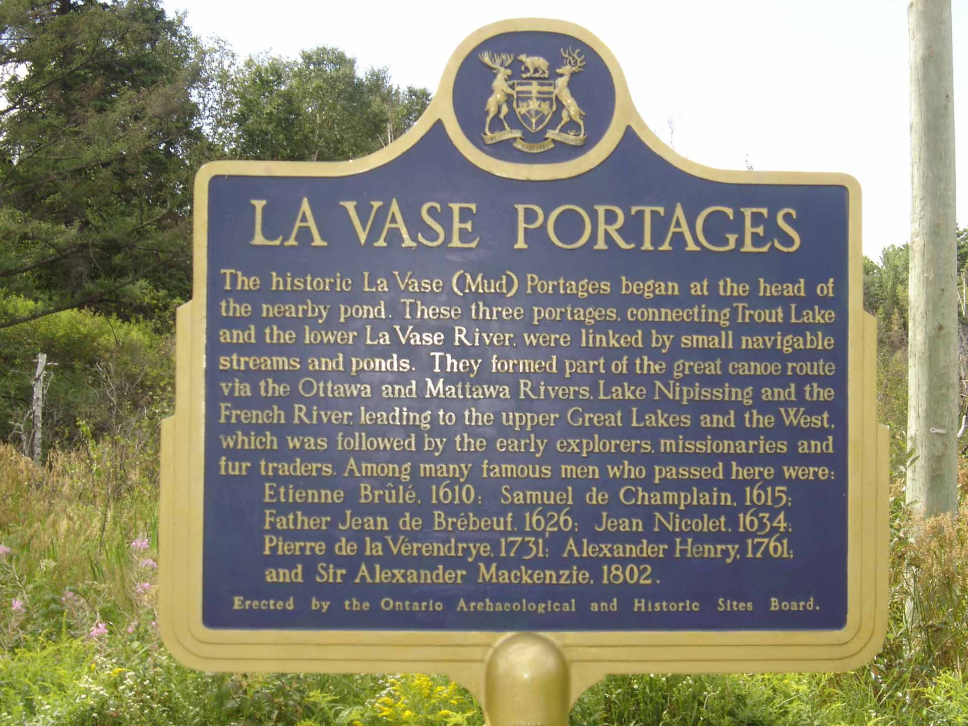
The La Vase Portages are a 10 km section of the historic Voyageur canoe route, that connects Trout Lake and Lake Nipissing. The route was used for thousands of years by First Nations to the time of European contact. Europeans, including Etienne Brule and Samuel de Champlain learned of the route from First Nations guides and it was soon established as a major artery into the interior of North America.
![]() The following details were provided by the Friends of La Vase Portages. More information on the portages and volunteer efforts to protect the historic route can be found on their website.
The following details were provided by the Friends of La Vase Portages. More information on the portages and volunteer efforts to protect the historic route can be found on their website.
Upper Portage
The Upper Portage links Brandy Lake to the middle of the Cooper’s Lake section. This mile long section of La Vase Portages route is probably the most pleasant section of the route to travel, so take your time and enjoy the paddle. The beaver dam at the south end of the lake has been recorded on maps from 1845 and is responsible for keeping the canoeing channel from 6 to 8 feet deep most of the year round.
Middle Portage
This second Portage has several variations.
The easiest route, when water levels are reasonable, is via a channel that runs from the beaver dam at the south end of Cooper Lake. The user is able to paddle most of the way along this long channel, which runs from north to south, lifting once and a while over a beaver dam. The route will eventually lead to active train tracks. Once users encounter the tracks, they should stick to the trail on the west embankment, and follow the tracks until the trail picks up again 200 yards down, returning to the La Vase River. Once back in the river, follow the watercourse west towards Lake Nipissing. About 30 minutes of paddling downstream will lead users to the Lower Portage.
Another option is to paddle along from the north to about mid way through where users will encounter Birches Road. It is easiest to walk around this road on the east side. Current property owners are supportive of the Friends of La Vase Portages and have allowed their property to remain flagged and brushed along the west bank of the swamp area, which starts just above the beaver pond. This route continues to the rail tracks at the south end. Following the active tracks, users will encounter La Vase River. Once back in the river, follow the watercourse west towards Lake Nipissing. About 30 minutes of paddling downstream will lead users to the Lower Portage.
** Users are strongly advised not to enter the River before the trail marker for safety reasons.
Lower Portage
The shallow water and numerous rocks throughout this section will require lining and wading in several locations.
For contemporary paddlers, the preferred route is along the current waterway. This route may not be manageable for others, however, where the option would be carrying through a subdivision, across Lakeshore Drive, and through a driving range in order to reach the river again.
The river turns sharply from east/west to north/south starting at the north end of the trailhead. This section runs over sharp and shallow rocks just below an old mill site. Wading or lining with good footwear is appropriate. The rocks come and go as users work towards the backside of a golf course. Shortly after, paddlers will reach the deeper water, and a half an hour’s further paddling will bring visitors to Lake Nipissing.
Annual Event
Each year, the Friends of La Vase host a Heritage Canoe Day on the third Saturday in July. If you like bugs, mud and french fries then this is the canoe day for you! Revered by the Voyageurs as a morass of mosquitoes and waist deep mud, these days the Friends of La Vase leisurely paddle and portage the route with little more than a sun hat and a water bottle (but don’t forget to bring your canoe and paddles as well).
Ownership Crown Land and Private Property
Management North Bay-Mattawa Conservation Authority and the Friends of La Vase Portages
Length 10 km
For More Information
CONTACT: FRIENDS OF LA VASE PORTAGES
ADVENTURE TRAILS MAP
Print map with 1000 kms + of hiking, cycling, paddling, cross-country skiing and snowshoeing trails across Ontario’s Near North